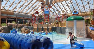
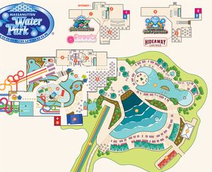
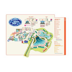
When Massanutten WaterPark was built a map was created of the facility. Since that time the map files had been lost, and the printed versions had deteriorated. We were brought in to create a new version of the map, incorporating changes and additions to the facility since its inception. The challenge was that aerial drone shots of the facility were prohibited, not to mention the interior layout is under roof and therefore is not visible from above. We worked from what was left of the original renderings, as well as countless on-site visits to get the layout correct, to create a visually appealing map that aids guest in navigating the facility with ease.
Massanutten Water Park
Water Park Grounds Map
Working with Dusty to create a map was a very smooth process. They were on top of the details and provided great options to enhance the project from start to finish!Dana Staniunas — WaterPark Manager